10 Easy Scenic Walks in Victoria, BC

This post may contain affiliate links. If you make a purchase through them, we may earn a small commission (at no cost to you).
One of our favorite things to do in Victoria (where we live) is simple. Go for a walk!
The capital city of British Columbia, Victoria is blessed with miles of seaside paths, flower-filled parks and pretty tree-lined streets.
Busy hummingbirds flit from bush to bush and bald eagles soar overhead.
So lace up your walking shoes and let’s head outdoors! ‘Coz there are lots of great easy hiking trails and scenic walks in Victoria, BC!
Featured reader comment
Easy walks in Victoria, BC

Contents: 10 Picture-perfect Victoria, BC, walks
8) Oak Bay Walk: Cattle Point to Marina
1) Songhees Westsong Walkway
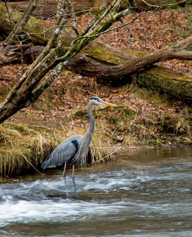
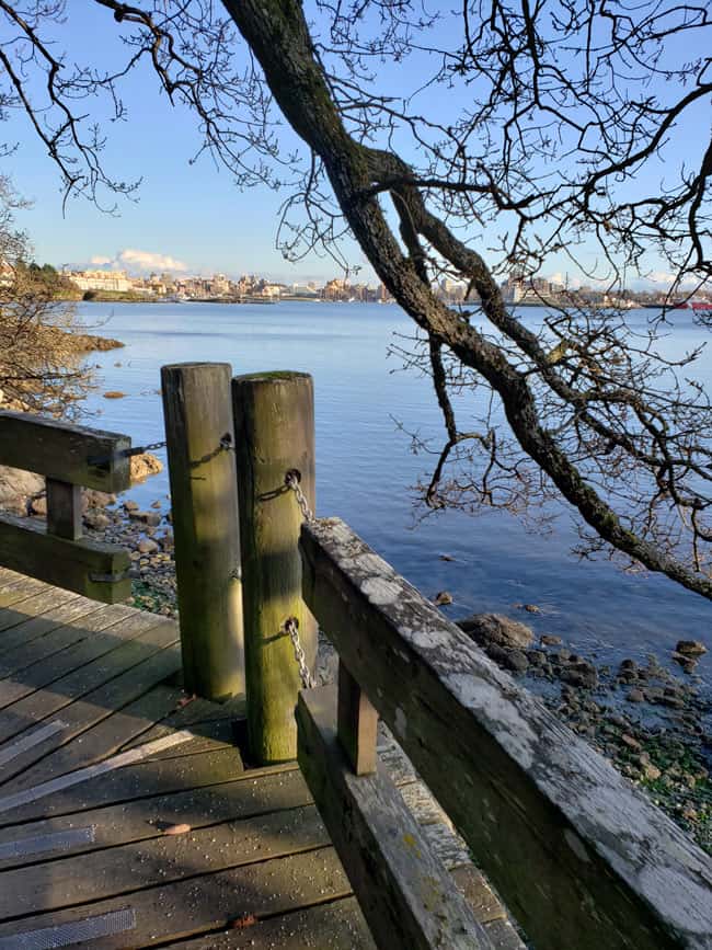
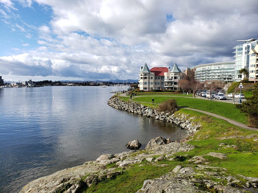
The Westsong Walkway is a flat walking trail running along the Vic West and Esquimalt waterfront.
It’s a mix of paved trail and wooden boardwalks (so accessible for strollers and wheelchairs).
There’s lots of parking on the side-streets by the Delta Victoria Ocean Pointe Resort, so this is a good place to start your walk.
Winding around the scalloped coastline, the walk offers lovely views of all the action in the Inner Harbour.
Watch seaplanes take off and land and people rowing dragon boats.
Herons often perch on rocks by the seashore, and near the Spinnakers pub, you might see otters and seals in the water.
Benches scattered along the way allow you sit for a while and soak in the sunshine and views.
The walk ends at the docks of the West Bay Marina, beyond which there’s a very mod public toilet (B on the map). There’s a float home village as well.
We often stop for coffee at the stylish Boom + Batten restaurant and café on the way back.

Perched on concrete pylons over the water, the steel-and-glass restaurant looks like the crest of a wave.
From the restaurant, you can ogle some ginormous white yachts in the adjacent new marina.
Songhees Walkway
- Distance: About 3 miles (5 km) there and back
- Time: About an hour
- Map: See our map created on Google for this Songhees walk
2) Rockland walk


Dating back to the 1880s, Rockland is one of the oldest neighborhoods in Victoria.
The equivalent of San Francisco’s Nob Hill, it was home to wealthy bankers, politicians and entrepreneurs.
During a housing shortage in the 1940s, several of the mansions were converted inside into apartments (now condos). But from the outside, they still look like grand estates today.
We live in Rockland, so this is the Victoria walk we do most often. And we never tire of it!
Rockland walking map
Here’s our map for this Rockland walk.
We designed it to highlight some of the best attractions in Rockland.
At some points, you do have to retrace your steps – but everything always looks different on the way back :-).
A – Government House
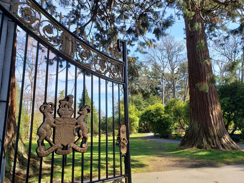
Start at Government House, home of BC’s Lieutenant Governor (A on the map).
Open to the public, its sprawling gardens and grounds – one of the top gardens in Victoria – are open to the public (free).
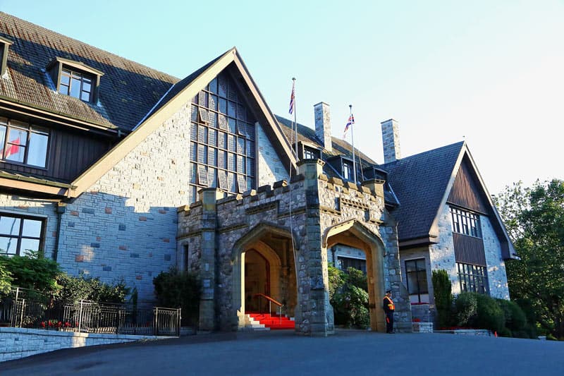
We usually save walking around the gardens for the end of the walk.
Otherwise you could get side-tracked by all the blooming rhodos and camellias in spring and roses in summer!
B, C and D – Cardio

Walk west along Rockland Avenue (C).
For a little cardio, deek down Lotbiniere Avenue (B) and Robleda Crescent (D), then retrace your footsteps back up these steep streets.
You’ll definitely be huffing by the time you get to the top of each!
And keep an eye out for the wild deer that like to munch on the greenery there.
E – Rockland Avenue
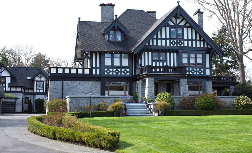
Continue walking along Rockland Avenue (E).
Look at all the lovely homes – try not to feel house envy :-).
F – Art Gallery of Greater Victoria

Turn right up Moss Street to the Art Gallery of Greater Victoria.
It’s interesting to view from the outside, as it comprises an historic 1889 mansion connected to a modern low-rise concrete building (which houses seven galleries).
If you haven’t visited, put it on your to-do list for later.
G, H and I – Craigdarroch Castle

Now turn around and go back down Moss Street and Rockland Avenue.
Turn left at Royal Terrace and follow the map to Craigdarroch Castle.
Then walk down Joan Crescent, named after Joan Dunsmuir, whose husband Robert (a coal baron) built Craigdarroch Castle.
J – Government House Gardens
Now you’re back at the Government House gardens.
Smell the roses (in summer). You can open the black metal gates – they’re there to prevent deer from entering and enjoying a petal picnic.
And don’t forget to walk the woodchip Woodlands Trail! There’s a bit of an uphill incline at the end for a touch more cardio.
Rockland Walk
- Distance: About 2.5 miles (4 km)
- Time: About an hour
- More information: See the Rockland Neighbourhood Association for more on the history of Rockland, with details on specific homes and points of interest.
3) Dallas Road
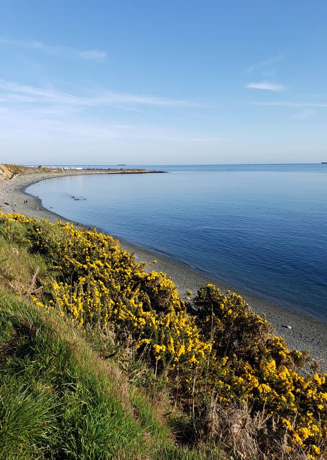
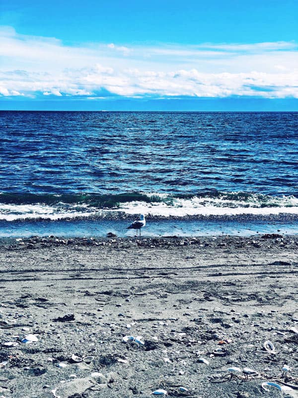
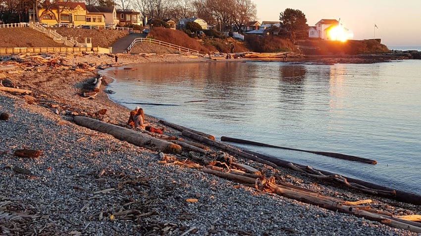
Dallas Road is a waterfront street running from St. Charles Street in the Fairfield neighborhood to Erie Street in the James Bay area.
Alongside it is a flat paved walking path overlooking the beaches and ocean.
And the Dallas Road path is one of the best walking trails in Victoria, BC!
We like the stretch between Clover Point and Ogden Point. There’s lots of parking at Clover Point as well as spots along Dallas Road itself.
On clear days, you get incredible views of the snow-capped Olympic Mountains (in Washington State across the Juan de Fuca Strait), outlined clearly against the blue sky.
You can break off and walk along paths running by the pebble beaches.
And in front of Beacon Hill Park, the green space is an off-leash dog park – it’s always fun to watch our furry friends running around.
This easy trail is ideal for a sunset walk as it faces southwest.
It’s also very popular in warm weather, with lots of people out and about on sunny days – making it a great spot for people-watching too.
When it’s windy, paragliders soar above the cliff’s edge.

Dallas Road Walk
- Distance: 3.6 miles (6 km) roundtrip; 1.8 miles (3 km) each way
- Time: About 1+ hour to 90 minutes regular walking pace
- Map: Check out our Google map on this Dallas Road walk
4) Ogden Point Breakwater

At Ogden Point, a long concrete pier juts out far into the sea – the Ogden Point Breakwater – protecting boats and traffic in the harbor from rough seas.
And you can walk (or jog) to the end of the pier to the lighthouse and back.
Watch the ferries, sea planes and helicopters come and go. Keep an eye out for seals which sometimes pop their heads out of the water.
Fishermen and scuba divers are often seen in summer down on the large cement blocks below at the water’s edge.
Note: You can add on the Ogden Point Breakwater walk to your Dallas Road walk (#3 above) to make that walk longer.
Ogden Point Breakwater Walk
- Distance: 1+ mile (1.8 km) out and back
- Walk time: 30 minutes’ slow strolling
5) MacAulay Point Park

In the Esquimalt neighborhood, MacAulay Point Park is an idyllic park with several walking trails meandering through forests and along the coast to rocky lookouts.
Park at the Munro Road parking lot by Fleming Beach, home to the Esquimalt Anglers Association, responsible for the boat ramp, boat launch and clubhouse on site.
There’s also some street parking at the end of Clifton Terrace.
The park was once used as a fort, and a couple of WW II military bunkers and lookouts still remain. In one, you can walk through a small tunnel.
Don’t miss the eagle’s nest!
Just follow the eagles soaring overhead to see where they land high up in the trees.

From MacAulay Point Park, it’s a short walk to Saxe Point Park – more beautiful water views there!
MacAulay Point Park and Saxe Point Park Walk
- Distance: About 2 miles (3+ km)?
- Time: About 1 hour of rambling
- Map: See this link on Google Maps showing the location of MacAulay Point Park in Victoria
- More information: See “Welcome to Historic Fort MacAulay” on the Esquimalt District’s website.
6) Beacon Hill Park

One of the best places to walk in Victoria, BC, is Beacon Hill Park.
This urban park is right in downtown Victoria.
With almost 200 acres of manicured flower beds, native Garry Oak meadows, grassy lawns, picnic areas, ponds and trails, it’s popular with both locals and tourists alike.
There’s parking on Dallas Road as well as on some side streets around the park.

We often first walk through the grounds of St. Ann’s Academy (a National Historic Site), then cross Southgate Street into the park.
Once in Beacon Hill Park, we just wander where we feel like.

Showy peacocks strut about, ducks waddle around various ponds and lagoons, and a blue heron’s nest always causes us to look upward to see if we can spot any baby herons.
The park is also home to the 128-foot-high Story Pole – one of the world’s tallest totem poles.
Beacon Hill Park Walk
- Distance: About 1.5 miles (2.5 km)?
- Time: 1+ hour of leisurely strolling
- Map: Download a PDF map of Beacon Hill Park
- More information: See the City of Victoria site on Beacon Hill Park
7) The Gorge Waterway
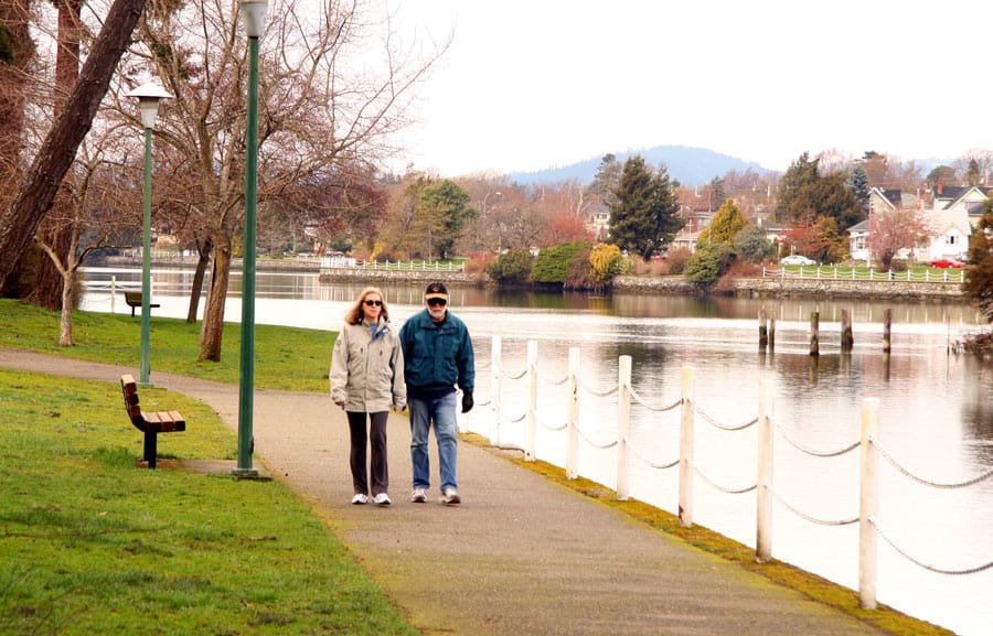
Another nice easy walk is along the Gorge Waterway Park.
This linear park runs parallel to the Gorge waterway in Saanich.
The Gorge itself is a narrow tidal inlet that extends some 4 miles inland from the Victoria Inner Harbor. A fun activity is to explore the picturesque channel on a Victoria Harbour Ferry Gorge tour.
The 1-mile stretch of the paved Gorge Waterway Park trail runs between Tillicum Road and Admirals Road.
Perhaps start at the Gorge Park parking lot off Gorge Road. You’ll pass a children’s playground, then the Victoria Canoe and Kayak Club.
The landscaping is lovely all along the path, with lots of colorful flowers, and the water views are very Zen.

Gorge Park Waterway Path
- Distance: 1 mile (1.7 km)
- Time: 30 to 40 minutes there and back (15 to 20 minutes each way)
- Location: See Google Maps to find the Gorge Park Waterway Path
- More information: See the District of Saanich site on Gorge Waterway Park
8) Cattle Point to Oak Bay Marina

One of our favorite Victoria walks is this seaside walk running between Cattle Point and the Oak Bay Marina.
It’s just a short drive from downtown Victoria (7 to 10 minutes or so), and there’s lots of free parking at both places, so you can start from either end.
Cattle Point is part of Uplands Park, where native Garry Oaks with their gnarly branches flourish.
There’s a boat ramp for launching your boat or kayak; moss-covered boulders offer convenient spots for plonking yourself down and taking in the water views.
Cattle Point is also a “dark sky” oasis – meaning it has no lights at night so you can better see the stars in the sky.
From Cattle Point, walk along Esplanade, the road running alongside Willows Beach.

One of the best beaches in Victoria, Willows Beach is a great place in summer to spread your blanket out on the sand and read a book.
It’s our go-to beach for SUP boarding. We also like having a picnic on the lawn on warm summer evenings.
When the beach ends, continue along Beach Drive with its lovely waterfront homes to the Oak Bay Marina.
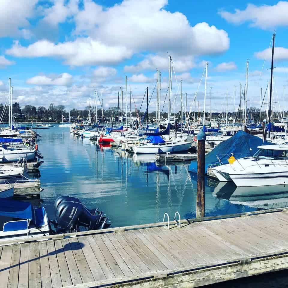
Cattle Point to Oak Bay Marina Walk
- Distance: 2.5 miles (4 km) return; 1.25 miles (2 km) each way
- Time: About 1 hour
- Map: Here’s the link to our map on Google for the walk from Cattle Point to the Oak Bay Marina
- Want to make this walk longer? Continue walking along Beach Drive (see #9 below)
9) Oak Bay Marina to Anderson Hill Park Loop

The last in our round-up of easy best walks in Victoria, BC, is this Insta-pretty loop.
Start at the Oak Bay Marina (A on the map), where there’s plenty of free parking.
Then walk along Beach Drive, past the Oak Bay Beach Hotel (one of the best hotels in Victoria). You’ll go by the Victoria Golf Club – check out the golfers hitting balls on the manicured greens.
The walk continues to throw up gob-smacking ocean views until you hit Transit Road on McNeill Bay (B on the map), where you turn right.
About a block up Transit Road, you’ll see a footpath to the right.
Take this Centennial Trail footpath. It leads through Garry Oak forests, bramble bushes and other shrubs to Anderson Hill Park.

(We couldn’t draw the map correctly on Google Maps – you’re actually going from about Point C on the map to Point D, via the footpath between two houses. If you miss the footpath, don’t worry, you can still go from Transit Road to Central Avenue and then right at Island Road to reach Anderson Hill Park.)
At Anderson Hill Park, soak in the stunning views of McNeill Bay below and Mt. Baker and the Olympic Peninsula beyond.
In spring, blue camas flowers blanket the rocky terrain and Scotch broom adds bright pops of yellow color to the scenery.
Upon exiting the park, head down Island Road, and turn left on Newport Avenue.
This pretty street with lovely Tudor and Craftsman-style homes takes you back to the Oak Bay Marina.
Oak Bay Loop Walk
- Distance: About 3 miles (5 km)
- Time: 75 to 90 minutes
- Map: See our map on this Oak Bay Marina to Anderson Hill Park walk
- More Oak Bay walks: See “Oak Bay Walking Trails”
10) Mount Douglas hike

For a little more of a cardio workout, head to Mount Douglas, about a 20-minute drive from downtown Victoria.
Mount Doug, as it’s commonly known, is an urban mountain in Mount Douglas Park. The 188-hectare park is made up of mostly dense forest (cedar trees and some arbutus trees), with 21 km (13 miles) of different trails.
Most trails wind their way up the mountain, which is about 213 meters (710 feet) high. They offer some of the best hiking in Victoria (right in the city).
If we’re hiking, we like to do the Irvine Trail, which is a short moderate hike. It’s one of our favorite hikes in Victoria in the summer months.
Alternatively, you can walk up Churchill Road (paved). It zig-zags its way up to the teeny parking lot near the top of Mount Doug. From there, it’s a short steepish walk to the summit of Mount Doug.
Your reward? On a clear day, you’ll enjoy a breathtaking 360-degree view!
To the east, you can see all the way across Haro Strait to San Juan Island. To the south, you see downtown Victoria. To the north and west, you look across the Saanich Peninsula.
If it’s been raining and the trails are muddy, walking up Churchill Road is a great option. It’s also an easier walk than hiking up Irvine Trail, for example.
Mount Douglas walk (or hike)
- Distance: About .9 miles (1.5 km) one-way
- Elevation gain: 213 meters (710 feet)
- Time: About 1 hour round-trip if walking up the road
- More information: See this Mount Doug trail map
That’s it for our round-up of Victoria, BC, walking trails!
As you can see, there are plenty of picturesque places in Victoria to get your walk on. Enjoy!
More of our Victoria travel guides
- A Local’s Guide to Victoria’s Best Activities
- Our Favorite Beaches in Victoria
- Top 10 Luxury Hotels in Victoria
- 7 Great Butchart Gardens Tours
- Best Eats in Victoria: 15 Restaurants Locals Love
- How to Get to Victoria (7 Different Ways)
- 7 Beautiful Gardens to Enjoy In Victoria
- Taking the Ferry From Vancouver to Victoria
- Explore the Gorge on a Fun Pickle Boat
- 5 Charming Airbnbs and Vrbos in Victoria
Pssst! Save this for later on Pinterest

Our top travel tips and resources
General trip planning: TripAdvisor is a helpful starting point, offering loads of user reviews on hotels, restaurants and things to do.
Hotels: Booking.com is our go-to for scoring a “wow” hotel – or at least a decent one – often at lower rates than the hotel’s own website. We especially like Booking’s flexible cancellation policy! (You may prefer Expedia for booking hotels in the U.S. or Mexico.)
Vacation homes, condos and rentals: We prefer and use Vrbo (Vacation Rentals by Owner).
Flights: For the cheapest flights, search on Google Flights or Expedia. (Just be aware Expedia tickets are often non-refundable. If you want more flexibility, it’s usually worth booking directly with the airline, even if it costs a bit more.)
Airport lounge access: We love (and have) Priority Pass for comfy lounge seats, free snacks and drinks, complimentary WiFi and sometimes even showers and spa services!
Tours: For the best local food, walking and other guided tours, plus skip-the-line tickets to attractions, check out Viator (a TripAdvisor company) and GetYourGuide.
Car rental: Renting a car is often a great way to explore off the beaten path. Discover Cars searches car rental companies so you get the lowest rates.
eSIMS: Stay connected affordably with Airalo eSIMS covering 200+ countries and trusted by 10 million+ users, including us! (No more huge roaming bills!)
Travel insurance: SafetyWing is designed for frequent travelers, long-term adventurers and digital nomads. It covers medical expenses, lost checked luggage, trip interruption and more. We also have and recommend Medjet for global air medical transportation.
Travel gear: See our travel shop to find the best luggage, accessories and other travel gear. (We suggest these comfy travel sandals for city walking, the beach and kicking about.)
Need more help planning your trip? Check out our travel tips and resources guide for airline booking tips, ways to save money, how to find great hotels and other crazy useful trip planning info.
If you make a booking or purchase through our site, we may earn a small commission (at no cost to you). Thanks!
Photo credits: 29 District of Oak Bay | 32 Victoria Golf Club | 32 Oak Bay Tourism
About the authors

